


0831214 - NEW SALEM Voting District, Dade County, Georgia
About
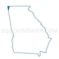
Outline

Summary
| Unique Area Identifier | 561047 |
| Name | 0831214 - NEW SALEM Voting District |
| County | Dade County |
| State | Georgia |
| Area (square miles) | 30.44 |
| Land Area (square miles) | 30.37 |
| Water Area (square miles) | 0.07 |
| % of Land Area | 99.78 |
| % of Water Area | 0.22 |
| Latitude of the Internal Point | 34.80554440 |
| Longtitude of the Internal Point | -85.47144500 |
Maps


Graphs
Select a template below for downloading or customizing gragh for 0831214 - NEW SALEM Voting District, Dade County, Georgia


Neighbors
Neighoring Voting District (by Name) Neighboring Voting District on the Map
- 0831038 - SOUTH DADE Voting District, Dade County, GA
- 0831889 - WEST BROW Voting District, Dade County, GA
- 083960 - TRENTON Voting District, Dade County, GA
- 2951161 - MOUNTAIN Voting District, Walker County, GA
- 2951800 - DAUGHERTY Voting District, Walker County, GA
- District One, DeKalb County, AL
Top 10 Neighboring County Subdivision (by Population) Neighboring County Subdivision on the Map
- Trenton CCD, Dade County, GA (8,611)
- Valley Head-Mentone CCD, DeKalb County, AL (4,304)
- Lookout Mountain CCD, Dade County, GA (3,750)
- Kensington CCD, Walker County, GA (3,264)
- Lookout Mountain CCD, Walker County, GA (3,043)
Top 10 Neighboring Unified School District (by Population) Neighboring Unified School District on the Map
- Walker County School District, GA (65,673)
- DeKalb County School District, AL (57,097)
- Dade County School District, GA (16,633)
Top 10 Neighboring State Legislative District Lower Chamber (by Population) Neighboring State Legislative District Lower Chamber on the Map
Top 10 Neighboring State Legislative District Upper Chamber (by Population) Neighboring State Legislative District Upper Chamber on the Map
Top 10 Neighboring 111th Congressional District (by Population) Neighboring 111th Congressional District on the Map
Top 10 Neighboring Census Tract (by Population) Neighboring Census Tract on the Map
- Census Tract 401.01, Dade County, GA (4,992)
- Census Tract 9614, DeKalb County, AL (4,304)
- Census Tract 403, Dade County, GA (3,750)
- Census Tract 401.02, Dade County, GA (3,619)
- Census Tract 208, Walker County, GA (3,264)
- Census Tract 204, Walker County, GA (3,043)